Ways

Descriptions with maps, travel details, distances, physical difficulty of walks and other ways to explorer the great outdoors and have yourself a “Grand Day Out”

Garvagh Forest

Maps and photos note: click or tap to see any maps or photographs below as a high resolution version.

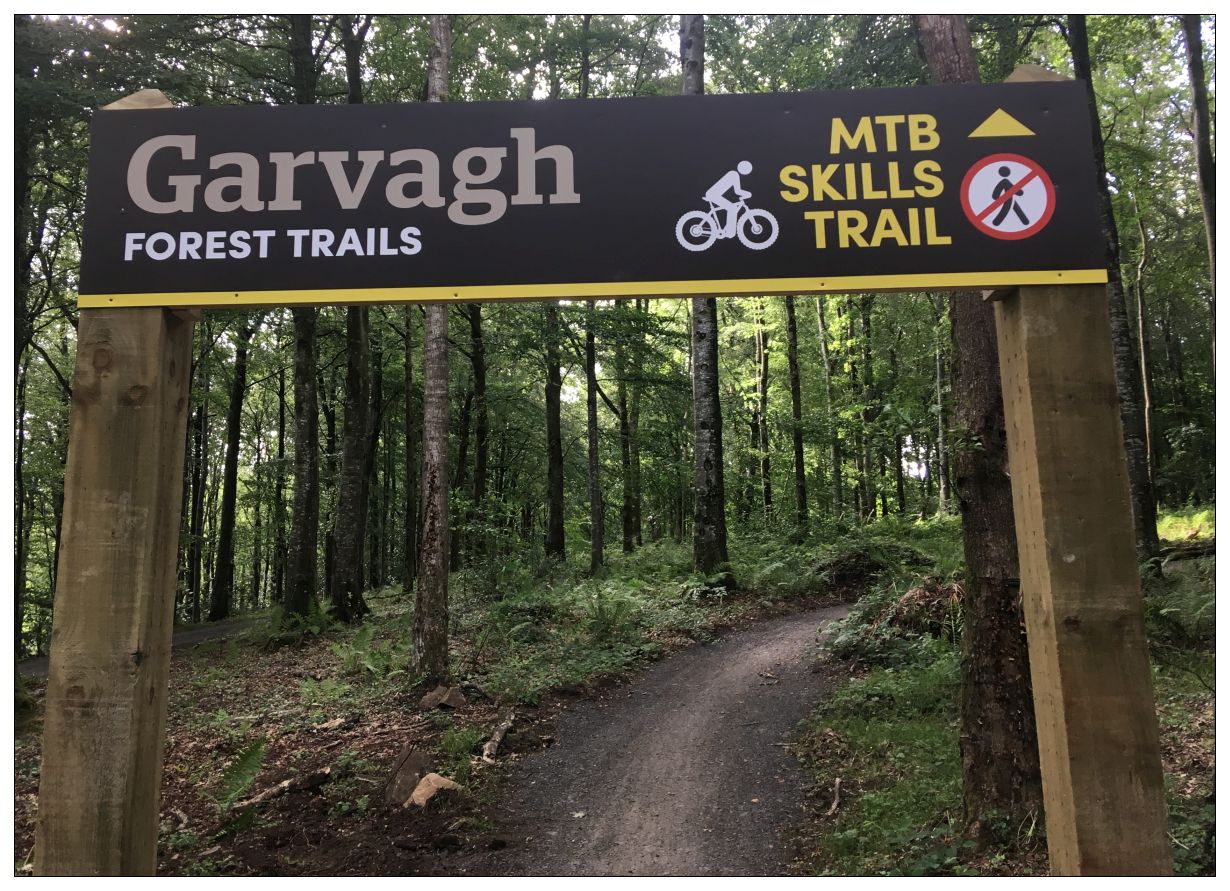
The new network Garvagh Mountain Bike Trails have now been officially launched (June 2019). Unfortunately all the though-forest trails are for Mountain Bike use only and there is no new forest trail provision for walkers who are expected to confine themselves to the existing network of forest roads (as shown above). On the plus sign new waymarks have been provided for walkers on the forest roads so it will make it easier for visitors without a map to find their way.

The new mountain bike facility looks very exciting, but it is sad that an opportunity to provide forest access for walkers has been missed.

For details see the Garvagh Forest Page on the Visit Causeway Coast and Glens Website.

Garvagh Forest only showing vehicle tracks which should remain usable for walkers

Map to Download and Print (PDF)

Garvagh Forest

back to top

Portglenone Forest

Maps and photos note: click or tap to see any maps or photographs below as a high resolution version.

Please reuse this map but first see: https://www.openstreetmap.org/copyright

Portglenone Forest is rightly well known for its annual display of spring bluebell bloom. Given that this will only be at its best for a couple of weeks sometime around May and that the area is small – this might lead you to think of it as a bit of a ‘one trick pony’ and not somewhere to visit all year round. This however would be a mistake. Bluebells (like wood anemone) are very slow spreading woodland plants. Their presence is an indicator of ground which has been forested for considerable time – ie old forest. Old forest as we know is rich in biodiversity and rare. So where you find it, other riches follow.

Continue reading

Loughermore Summit and the Giant’s Grave

Maps and photos note: click or tap to see any maps or photographs below as a high resolution version.

Please reuse this map but first see: https://www.openstreetmap.org/copyright

There has been a lot of publicity and promotion in recent years about hillwalking in the Sperrins. There is a also a nice new Ordnance Survey 1:25000 outdoor activity map. However, the strange thing is that this is an area with almost no access to the hill summits; or associated car parking; or stiles over the many mountain fences. Apart from the usual problems of lack of rights of way or permissive paths, these are soft, wet, peaty mountains where paths would rapidly erode without substantial human intervention. So walkers here are reduced to the usual options of roads, lanes and Forest Service plantations. However, it is not all bad news – there are some good options, and Loughermore, which actually contains a trig point summit and great views of the Sperrins, Donegal and beyond, is one of the best.

Continue reading