Maps and photos note: click or tap to see any maps or photographs below as a high resolution version.
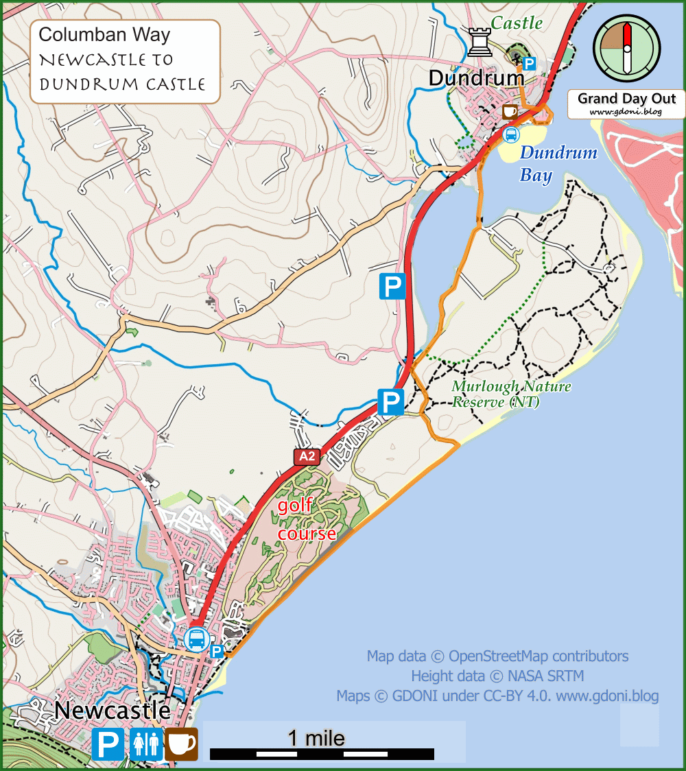
| TYPE | Coastal walk with beach (tidal), sand dunes, estuary urban and a ruined castle |
|---|---|
| DISTANCE | 4.7 miles / 7. km |
| SURFACES | Beach stony in places with pools. boardwalks, tracks, pavements and a short road walk |
| HEIGHT GAIN / LOSS | 190 feet climb |
| HAZARDS |
|