There has been a lot of publicity and promotion in recent years about hillwalking in the Sperrins. There is a also a nice new Ordnance Survey 1:25000 outdoor activity map. However, the strange thing is that this is an area with almost no access to the hill summits; or associated car parking; or stiles over the many mountain fences. Apart from the usual problems of lack of rights of way or permissive paths, these are soft, wet, peaty mountains where paths would rapidly erode without substantial human intervention. So walkers here are reduced to the usual options of roads, lanes and Forest Service plantations. However, it is not all bad news – there are some good options, and Loughermore, which actually contains a trig point summit and great views of the Sperrins, Donegal and beyond, is one of the best.
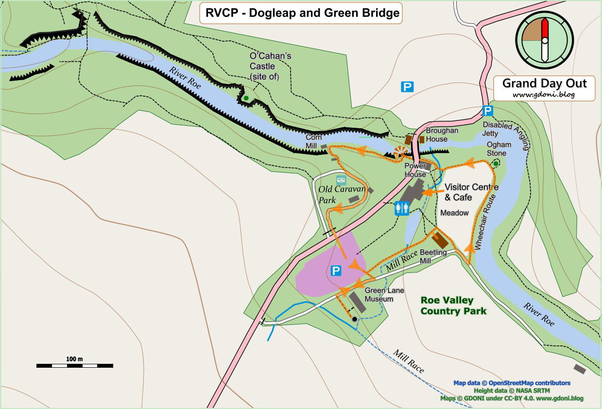
This walk visits the rocky wooded gorge of the O’Cahan’s – the ancient clan which controlled the Roe Valley area up until the time of the Plantation of Ulster. Even after they were displaced, the site of their castle remained a local seat of power and its associated community – the original Limavady (from the Irish Léim a’ Mhadaidh – the leap of the dog). Only later was Newtown-Limavady founded in its current location two miles to the north.
So this now uninhabited wooded riverbank was once a place of dwelling, agriculture and commerce. Few signs remain today save the ‘Holy Well’ (often an indication of pre-Christian origin) and the mound on which O’Cahan’s stronghold stood defiant high above the river gorge.
This walk explores the riversides upstream of the Dogleap Centre. This is a landscape moulded by the human requirements for water power, linen production and the milling of gain for bread, feed and even whiskey. There is a Linen Green, the remains of three weirs and mill race systems and many ruined mills and associated buildings. At the turn of the walk you have an option to leave the Country Park and visit a tranquil church following the “old ways” along a rough unmade path.