Maps and photos note: click or tap to see any maps or photographs below as a high resolution version.
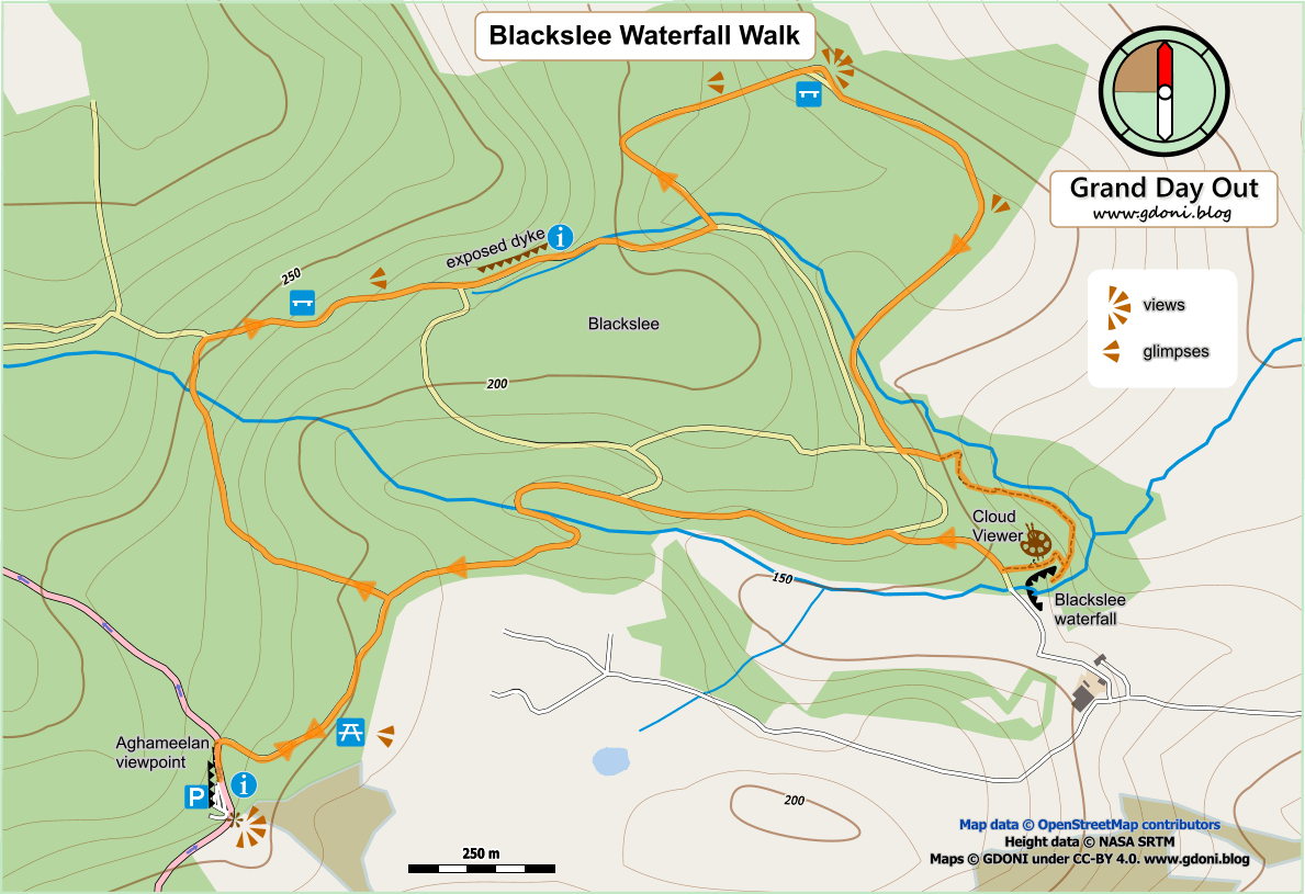
| TYPE | Largely circular forest track walk through conifer plantations with some excellent views, vistas and a short path section to visit a waterfall. |
|---|---|
| DISTANCE | 3.9 miles / 6.2 km |
| SURFACES | Mainly well made forest tracks with short section on good quality path with some climb and steps |
| HEIGHT GAIN / LOSS | 820 feet climb |
| HAZARDS |
This is a fully waymarked walk which already has a description and map available on the Marble Arch Geopark website. Like many of the Geopark walks it is contained within conifer plantation and largely confined to forestry vehicle tracks. However, it features great panoramic views and framed glimpses of the loughs and hills of Fermanagh. There is also a short forest path section which leads through an intriguing rock valley to to Blackslee waterfall – an abrupt hidden drop almost totally shrouded by encroaching woodland.
Continue reading