Blog

Reflections on experiencing the best of this little bit of world around us

Connswater and Comber Greenways Loop

Maps and photos note: click or tap to see any maps or photographs below as a high resolution version.
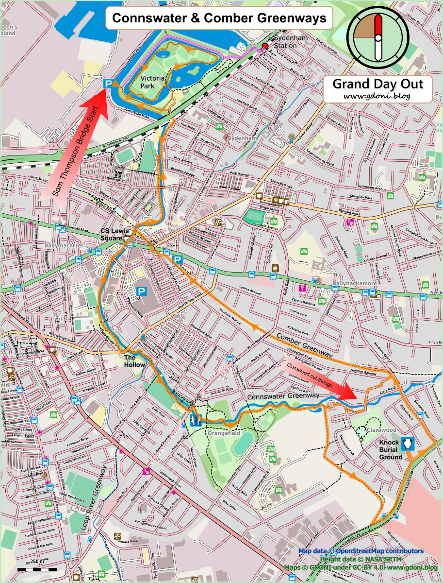

Please reuse this map but first see: https://www.openstreetmap.org/copyright

The creation of Greenways as a means of improving urban life has been one of the success stories of the 21st century. By providing local outdoor exercise, access to green space and linking communities separated by traffic, noise and pollution they can deliver community benefit in the long term. East Belfast is fortunate to have two of the best Greenways. The older Comber Greenway along a disused railway line is an efficient pedestrian and cycle route from the heart of the city far into open countryside. The newer Connswater Greenway ingeniously links existing parks via a rescued urban waterway and a great new cultural hub based around the imaginary world of Belfast author C S Lewis. This walk explores both.

Continue reading
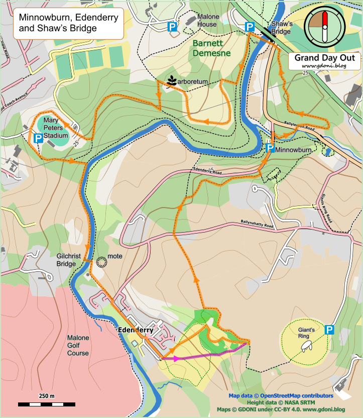
Minnowburn, Shaw’s Bridge and Edenderry

Maps and photos note: click or tap to see any maps or photographs below as a high resolution version.

Please reuse this map but first see https://www.openstreetmap.org/copyright

The Shaw’s Bridge to Edenderry riverside loop is probably one of the most popular walks in Belfast. This route however adds a number of twists to add variety, interest and less trodden paths. It also only follows the Lagan for 400m so is quite distinct from the popular variant.

Continue reading

Minnowburn and the Giant’s Ring Walks (overview)

Maps and photos note: click or tap to see any maps or photographs below as a high resolution version.

Please reuse this map but first see https://www.openstreetmap.org/copyright

The green wedge of the Lagan Valley Regional Park divides the City of Belfast in the best possible way. It starts as a sliver beside the Lagan at Stranmillis and widens and twists its way out of the city. Continue reading