

| TYPE | Linear walk from train station to train station |
|---|---|
| DISTANCE | 2.4 miles / 3.9 km |
| SURFACES | Mixed tarmac and earth/gravel – generally good – short section on sandy beach |
| HEIGHT GAIN / LOSS | 250 feet of descent and ascent |
| HAZARDS |
|
As the map above shows, this walk includes the whole of Crawfordsburn Country Park shore with extra coast and two station link sections. If you know Crawfordsburn it will give a fresh twist and if you don’t you should definitely do this walk – it is a great spot in all weathers.
The optional diversion includes a cafe and an excellent viewpoint with views out to the North Channel and Scotland.
On leaving the train exit North toward the sea. You will need to use the underpass if approaching from Bangor, but even if you don’t, have a look inside at the cheerful mosaic mural.

On exiting onto Killaire Road turn right towards the golf club. At the drive into the club the pedestrian path cuts sharp left towards the sea. As you drop briskly toward the coast you will soon get a view out to sea. If you can see Scotland clearly it may indicate it is going to rain – if you can’t it may well be because it already is!

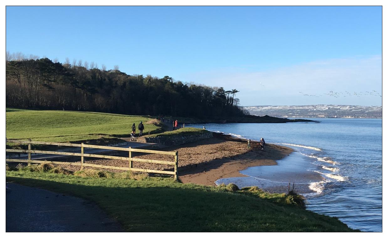
On reaching the coast path turn left and proceed past a small waterfall and round to the next headland. This is a pleasant spot where you can get off the beaten track and explore towards the sea. Looking back you will see Carnalea golf course and out-to-sea rocks, probably decorated with cormorants, and ahead the shoreline of Crawsfordburn Country Park stretching in the distance to Grey Point.


Rejoin the path and head west. After about 300m it drops into a sandy bay and the hard surface ends. You now have a short walk on a sandy beach – a pleasant interlude , but note the high tide marks on the photo below. At spring tides with onshore winds access cannot be guaranteed!

Leave the beach and return to the surfaced path. A short distance ahead a gravel path turns inland towards a network of woodland and meadow paths. The walk map covers this area in reasonable detail so the enterprising walker can plot their own variations here. However, our route stays on the coast.
Round the next corner and you will find yourself in Crawsfordsburn proper – a lovely long sandy beach with some rocks, lots of birdlife and happy dogs! Very popular with families all year round – it can become noisy and crowded in the event of a heatwave – hence the alcohol prohibition signs.

After crossing the stream you have the option of a short inland diversion. It provides an opportunity for a light refreshments and self indulgence at the visitor centre Woodland Cafe and a return route where you can remove a few of the extra calories with a sharp climb up to possibility the best viewpoint on the North Down Coast.
Visitor Centre Option
After crossing the bridge turn left and then immediately right to skirt along the back of the shore ‘green’. 100m on and turn left inland along the foot of a wild-flower meadow directly towards the visitor centre and cafe. As well as a cafe and toilets there there is a permanent wildlife exhibition.
On leaving the centre, pass the pond and when you come to the meadow turn sharp left up a gravel path and climb steeply to the top. At the top there are two benches sheltered from westerly winds with great views out over the Lough, North Channel and Scotland (with the previous proviso). Take a moment or two and enjoy. Now follow the path down to the corner of the meadow. Turn left through the wood and after 150m drop steeply down to rejoin the tarmac coastal path.
After the main Crawsfordsburn beach continue round the headland to the second shorter stretch of sand which is backed by Helen’s Bay Course Course. At the end turn left off the beach and head inland – or, joining Church Road turn right, and then shortly left into Helen’s Bay Car Park.
This large car park contains public toilets and at the inland end is the access point to the old Clandeboye Avenue, which will also take you directly to Helen’s Bay Station.
There now follows a pleasant secluded walk along a narrow tree-lined cutting. It is perfectly straight and low stone walls on each side give it the feel of a disused narrow-guage railway. As it was built to link the Clandeboye estate to the new North Down railway line it is possible the same navvies may have built both.
One last treat remains – Helen’s Bay Station. However, as you approach its turrets, arrow slits, overgrown hexagonal courtyard and grand arched entrance, you might think it has more in common with Disneyland than the average Northern Ireland Railways ‘bus shelter’ style station.
Built by Lord Dufferin to facilitate private access for his estate to the railway via a dedicated carriageway, it was designed in the “exuberant Scottish Baronial” style and featured a private waiting room in addition to the previously mentioned singular feature.

So finally through the grand archway, turn sharp left, climb up to where an arched doorway gives access to the railway underpass and your choice of station platforms.