Holywood

Label for posts relevant to Holywood

Helen’s Bay Station to Crawfordsburn Loop

Maps and photos note: click or tap to see any maps or photographs below as a high resolution version.

Please reuse this map but first see: https://www.openstreetmap.org/copyright
TYPECircular walk from train station to train station
DISTANCE2.2 miles / 3.6 km (Chimera Wood option)
2.6 miles / 4.2 km (Clandeboye Avenue option)
SURFACESMixed tarmac and earth/gravel – generally good.
HEIGHT GAIN / LOSS250 feet of descent and ascent
HAZARD– a busy road crossing
– short walk along the park access road without pavement (but with pedestrian marked lane)

This is a circular walk which does not require a train to complete. However, starting from Helen’s Bay station provides both easy access and a start with a surprise! There is a car park here but it is often full during commuting hours.

Continue reading

Time and Tides

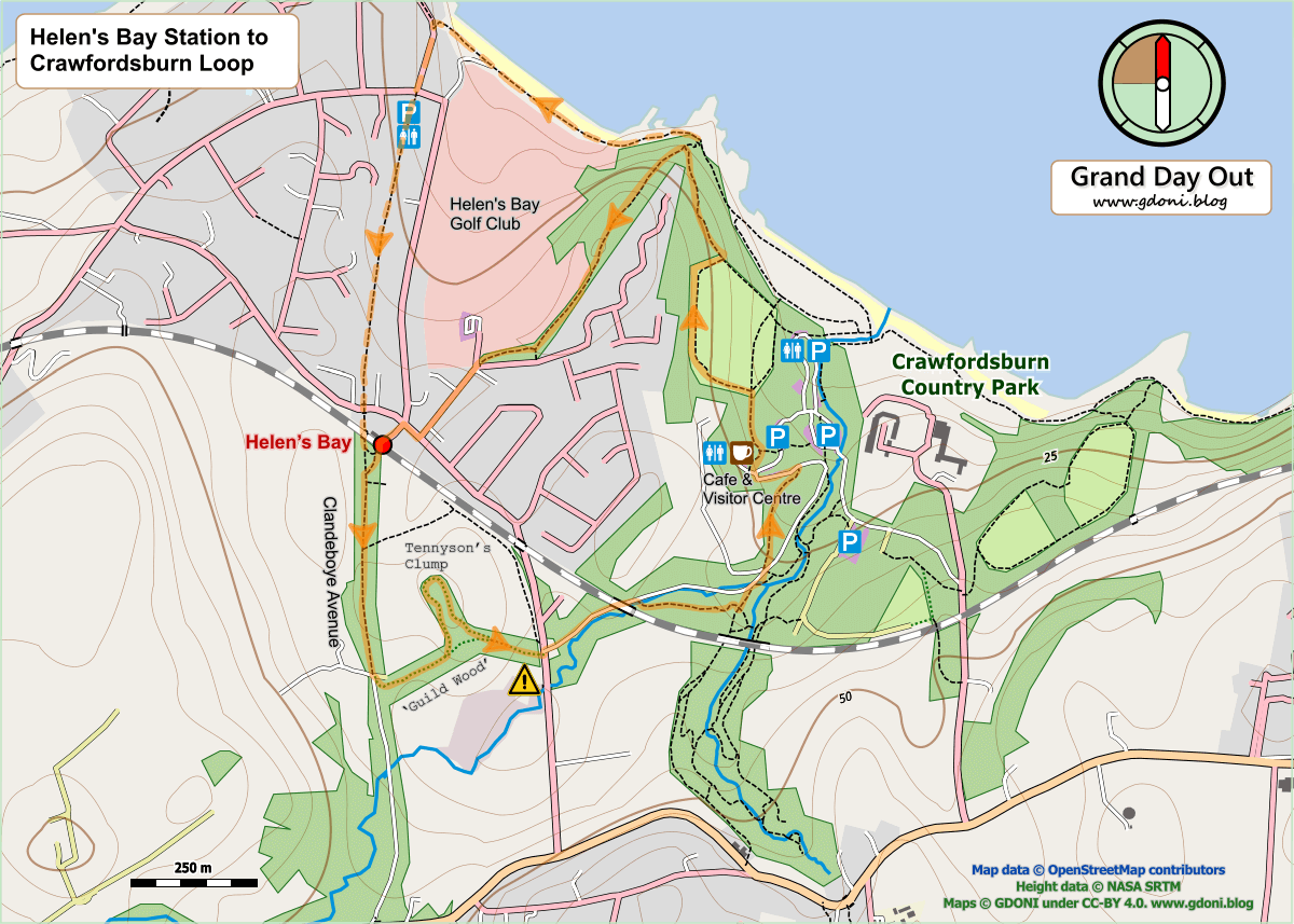
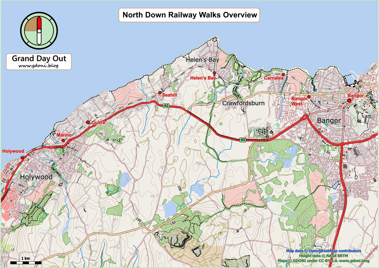
A number of the walks described in this blog follow the coast and therefore will be impacted on by the tides. The tide cycle will almost always affect the opportunities for wildlife spotting and change the coastal landscape. However, in extreme cases, they may make certain routes impossible or ill advised.

Bearing in mind the general dearth of rights of way for the foot traveller in NI, you will often find yourself relegated to the foreshore, the strip of land between spring low and high tides. Generally this is crown property and public access is permitted. However, by definition, there will be times at high tide (and onshore strong winds)  when access is impossible or at least ill-advised. Hence, when walking on the coast check the tides and avoid walks which are limited to the foreshore in places at high spring tides or in high winds.

Checking the tides in advance is much easier nowadays with online tidal predictions readily available either on the web or via smartphone apps. Free data tends to be limited to about a week ahead so if you are arranging a walk some time in the future you may need to use  a paid service.

Finally, tidal predictions will be for specific ports and not individual points on the coast. As high tide times can vary substantially along the coast it is wise to check times for points either side of your walk unless your are close to a listed port.

I have found the websites / apps below useful in the past (please note this is not a ‘product endorsement’- see our post on “Opinions not Endorsements”  for further explanation of this issue).

North Down Railway Walks (overview)

Maps and photos note: click or tap to see any maps or photographs below as a high resolution version.

Most keen walkers will have walked from Holywood to Bangor – 9 miles of traffic-free coastal bliss. Many will also have used the train to get back to their starting point.

The various excursions suggested here use permutations of Bangor line stations to deliver a full range of distances and opportunities for shorter and maybe slower walks to give sections of this coast the time and attention they deserve.  The link sections from the train stations to the coast add extra interest – glimpses of different housing styles and periods, tastes and aspirations.

The table below gives distances for 21 possible walks. The distances are from station to station. We have chosen a selection to describe individually and these can be accessed from the links below.

 From: Marino Cultra Seahill Helen’s Bay Carnalea Bangor
To Holywood1.42.13.95.97.19.2
To Marino 1.53.35.36.58.6
To Cultra  2.74.75.98.0
To Seahill   3.14.36.4
To Helen’s Bay    2.34.4
To Carnalea     2.4

Print out the PDF map below to get an overview of the route and options:

Links to Selected Ways

back to top